
Visual Representations Of A Regional Economic Subsystem. An Analysis


Abstract
This research includes an analysis of the visual representations elaborated for the features of the agricultural sector in the south-eastern region of Romania. The source of this visual imagery is a student’s project and PowerPoint presentation. The first author of this paper is also the one authoring the project and the respective imagery. Our study focused on several investigation directions concerning the student’s project: presentation structure and internal logics; information relevance; underlining the connections among subsystem components and between the respective subsystem and the ones at higher levels; identifying the strengths and weaknesses of the analysed economic sector, the extant and possible opportunities and threats; use of visual imagery (student’s own elaboration) such as thematic maps and charts about the subsystem components and relationships among those. We collected part of the research data about the content of the student’s project through the interview method and participatory observation. The analysis of this project was realised using three assessment grids comprising various criteria and indicators. The designed analytical tools were useful and increased the objectivity level of the assessment. We concluded that the results of our analysis and especially the assessment grid could be used in the future as feedforward in similar activities.
Keywords: Assessment gridcartographic competencesGISgeographical studyuniversity education
Introduction
During the Bachelor’s and Master’s studies, students from the Faculty of Geography develop transversal competences and competences which are specific to their specialisation (Andronache & Dulamă, 2020) and are included in the category of reproductive and productive competences (Brien, 1997). Research in the didactics of geography in Romania was focused on building and testing analytical assessment grids for reproductive competences, developed for geography students: to elaborate topographic profiles (Osaci-Costache et al., 2013b), to elaborate column charts (Osaci-Costache et al., 2013a). Other studies focused on using analytical assessment grids for productive competences in geography: to elaborate touristic plans (Osaci-Costache et al., 2013), to elaborate proposals of spatial planning measures for river basins (Dulamă, Ilovan & Niţoaia, 2016), to analyse the cultural landscape (Dulamă, Vana & Ilovan, 2016), to elaborate graphic organizers (Koszinski et al., 2019), to analyse landscapes during geography university studies (Ilovan et al., 2019), and to represent urban space (Dulamă et al., 2020).
The systemic nature of regions has been much explored, documented and represented through text and images in the last decades in the regional geographical literature of Romania (Ilovan, 2009) and Europe (Paasi, 2009), while discussing factors supporting and conditioning local and regional development.
Visual methods of producing and representing the regional space are part of the mixed (i.e. quantitative and qualitative) tools that Regional Geography uses when researching regional systems (Ilovan & Doroftei, 2017; Magdaş et al., 2018). Geography, as a visual discipline, has become increasingly careful about reflecting critically how it produces and interprets visual imagery (Bartram, 2010; Doroftei, 2017; Ilovan, 2019; Rose, 2014). In geography, images are used to represent space, relationships among spatial and societal components and thus enabling the transmission of knowledge in a world where the visual is occupying a central place.
Problem Statement
During the Master’s studies, the students from the Faculty of Geography develop a higher level of specific competences which are related to their specialization, by carrying out geographical studies and projects for a long period or for a semester. In these integrating activities, in order to build a system of competences, students face some difficulties. Students need a large amount of knowledge in regional geography, geographical systems and regional development and they need to understand, in a profound manner, the principles to elaborate a regional geography study. The lack of knowledge and understanding on how to approach specific questions of regional geography may be significant obstacles in managing this complex task successfully, and in broader terms, in students’ becoming sensitive to community and global issues (Albulescu & Albulescu, 2015.
Research Questions
Master students received the individual task to elaborate a case study on a subject which they could develop for a development region in Romania. They could choose from one of the three suggested topics by the professor (for example, energy sector, agricultural sector, labour force, and unemployment), providing that there were no thematic overlaps. For each subject, they were given an indicative structure. During the courses and seminars, the teacher provided students with directions, information, clarifications, answers to questions, workflows, and examples. Regarding the accomplishment of this task, the questions we will answer in this research are: What is the structure of this geographical study as designed and developed by the student? Which are the relevant geographical aspects that are presented and represented? How are highlighted the connections among the components of the agricultural sector and between this system and the higher-level systems? How are the visual images – thematic maps and charts – used to represent the components of the subsystem and the links between them? What are the strengths and weaknesses of the assessed economic sector, what opportunities and threats are noticed by the student?
Purpose of the Study
The aim of this research is to analyse the visual representations which were elaborated by a M.Sc. student, in order to highlight, through a case study, the specific characteristics of the agricultural sector in the South-East Region of Romania, in a PowerPoint presentation. Some aspects regarding the conduct of this geographical study and its analysis as a product was performed by the researchers, as external evaluators, after the student’s graduation. The visual representations are analysed taking into consideration the direct relationship with the text content and as integrated elements in the PowerPoint presentation, considered as a unitary product. To increase the quality of the analysis, this is realised using several assessment grids created by the researchers, so that those tools may be later used in the assessment of other geographical studies conducted by students.
Research Methods
Findings
Analysis of the presentation structure for the case study
Although a typical geographical case study is supposed to identify a problem, causes, conditions and solutions (Dulamă, 2010), we created this analysis taking into account the structure, which was proposed by the course professor, presented by the student, and a virtual structure, which was generated by the researchers. This virtual structure represents the “key” to a critical lecture. We took into consideration that the professor’s proposed structure
Based on the professor’s proposed structure and the student’s detailed aspects, in Table
Presented and represented relevant geographical aspects
From the analysis of the presented information from the text, the most (about 95%) was relevant to the topic (Table
Highlighting the connections between the components of the system
One of the strengths of this study refers to the interactions between the elements of the agricultural sector and higher-level systems (for example, the impact of relief, soils, and climate on agriculture). Aspects regarding connections on the same level were also addressed, for example: percentage of the employed population in agriculture, population aging, the lack of labour, and qualification level. In the oral presentation of the study, many more relations among the components of the agricultural system and between the system and higher levels were mentioned.
Representation of the components of the system and of the relationships among these, in visual materials
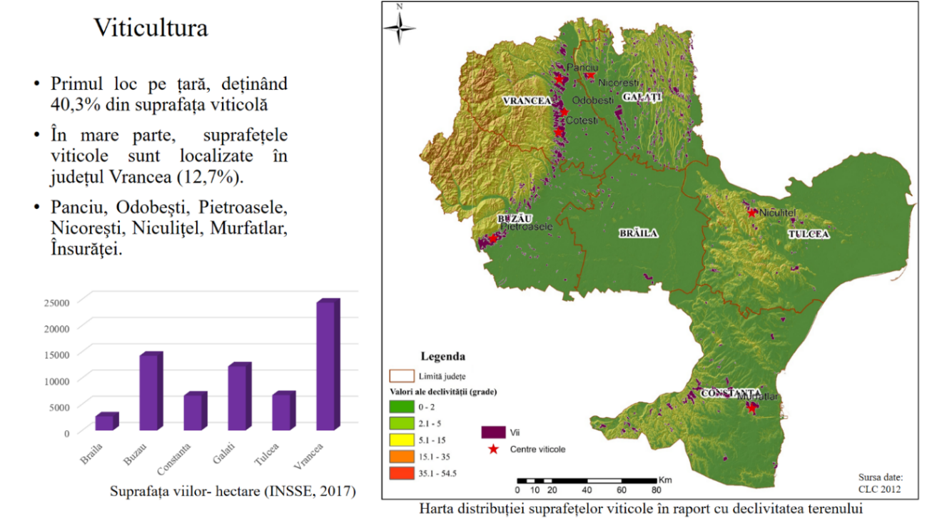
The analysis of the visual materials was the main objective of this research. We took into consideration not necessarily a cartographic perspective, but a perspective which allowed the geographical information representation in a manner easy to perceive and to understand by those who read the geographical study. In literature, there are specific grids for rigorous map analysis (Dulamă, 2010), column charts (Osaci-Costache, Dulamă & Ilovan, 2013), but in this case, an assessment of the set of maps and charts is required. To achieve this aim, we built an assessment grid of the visual materials (Table
In the analysis of the maps and charts, we took into consideration two aspects, which were considered criteria: the content and the execution. Regarding the content of the map and charts, three aspects were considered more important: the representation of all-important aspects for the subject, the representation of elements included in the studied area, correspondence among title, legend and content. For the maps, we also analysed the manner in which the elements included in the studied area were highlighted, and for the charts, we analysed the manner in which the hierarchies and the evolution of geographical processes were underlined. Regarding the creation of maps and charts, we analysed whether they included the necessary elements, if the cartographic requirements were met, if the data source and the author were mentioned. For the maps, we also assessed the dynamic of the data map and the percentage of the maps which were created from scratch, as well as the percentage of the processed maps.
For the PowerPoint presentation, we analysed three aspects: the text document, visual imagery, and slide organisation. For the analysis of the text in each slide, we analysed if it provided the necessary information on the topic (completeness), if it was brief / synthetic, if it had structure and if there was an optimal ratio between the essential information and the detailed, specific one. Regarding the visual imagery, we analysed the ratio between the position on slides with other materials and text, the size of the visual materials to ensure the visibility of details and legibility, the percentage of the occupied area with visual materials on each slide. We analysed more aspects regarding the concept and organisation for every slide: how the visual material combined with oral information, what was the degree of loading with the visual materials and text, how information on each slide was introduced (dynamic, interaction with the person who viewed the slide), and general appearance (Figure
The points indicate a creative and harmonious PowerPoint presentation, which keeps the focus of the viewer throughout its progress. The points from 1 to 10 (Table
The analysis of strengths, of weaknesses of the studied economic sector, of the opportunities and threats, existent and potential, within the SWOT Analysis
The mentioned aspects in the student’s geographical study were included into the assessment grid (Table
Conclusion
The conclusions of this research are focused on many directions in connection to the aim and the questions for which we looked for answers. A first conclusion refers to the evaluators’ competences, so that we highlight that in order to assess a case study in regional geography, the evaluators should have specific competences in this branch of geography, as well as assessment competences – which are specific to educational sciences – and allow them to design and test assessment tools. Having competences in both mentioned fields ensures the premises for a correct assessment study and conclusion, in order to capitalize the research results in other contexts.
Analysing the structure of the geographical study which was created by the M.Sc. student, we concluded that the student changed the title of some subtitles (suggested by the professor), but, within these, the student approached most of the necessary and essential aspects for such a case study, proving competences in structuring the contents in a thematic order. In the text information and in visual representations, which were included in the presentation, there are highlighted geographical aspects, which are relevant to the agriculture sector in the South-East Region, with the exception of some interesting information, but with less significance to the study. Both in text and in visual materials, there are presented and represented the components of the agriculture system and the connections among them, as well as between the higher-level systems and those which are similar, hierarchically. Highlighting the connections among the components of the systems was carried out in a creative manner, using signs (arrows), and introducing gradually elements in map content, in a spectacular manner, capitalizing the opportunities of the PowerPoint presentation.
The presentation of the agriculture system in the South-East Region was done rigorously, systematically, synthetically, comprehensively, and observing principles and requirements, which should be met by a study in geography. Together with the text, the visual imagery – maps and charts – are well integrated on each slide, providing the viewer with a complex image on each subtheme, but easy to perceive and follow. In the SWOT Analysis, more weaknesses were highlighted than strengths, more opportunities than threats (existent and potential), which indicated student’s good knowledge of the analysis method, of the agriculture system and of the South-East Region.
The analytical tools (the assessment grid of the text and its representation in visual materials; the assessment grid of the visual material; the assessment grid of the SWOT Analysis of the regional agriculture sector), which were designed to assess this case study, were useful and increased the objectivity level of the assessment, highlighted certain gaps and aspects which could be improved in future studies.
All in all, the case study met the requirements of a paper of geographical analysis for a region in Romania, from the perspective of the agricultural sector. The presented assessment tools can be used by professors and teachers to give feedback to students and to draw attention to the aspects which require additional information, having the purpose to develop competences and to aim toward continuous learning.
Acknowledgments
Authors contributed equally to this paper.
References
- Albulescu, M., & Albulescu, I. (2015). Overtones in contemporary educational theory and practice: education for democratic citizenship. In V. Chis, & I. Albulescu (Eds.), 3rd International Conference - Education, Reflection, Development. Book Series: Procedia Social and Behavioral Sciences, 209, 96-101. DOI:
- Andronache, D., & Dulamă, M. E. (2020). Transversal and specific competencies in the perception of the students in geography. In V. Chiș (Ed.), 7th Edition of Education Reflection Development International Conference 2019, European Proceedings of Social and Behavioural Sciences, 85, 713-722. DOI:
- Bartram, R. (2010). Geography and the interpretation of visual imagery. In N. Clifford, S. French, & G. Valentine (Eds.), Key Methods in Geography, second edition (pp. 131-140). Sage.
- Brien, R. (1997). Science Cognitive & Formation. Presses de l’Université de Québec.
- Doroftei, I. (2017). Chapter 6. Visual methodologies. In O.-R. Ilovan, & I. Doroftei (Eds.), Qualitative Research in Regional Geography. A Methodological Approach (pp. 117-130). Presa Universitară Clujeană.
- Dulamă, M. E., Ilovan, O.-R., & Niţoaia, A. (2016). Forming and assessing the competence to elaborate proposals of spatial planning measures for hydrographical basins. PedActa, 6(1), 16-27.
- Dulamă, M. E. (2010). Fundamente despre competențe [Basics of Competences]. Presa Universitară Clujeană.
- Dulamă, M. E., Ursu, C.-D., Ilovan, O.-R., Răcășan, B. S., Andronache, D., & Rus, G.-M. (2020). Representing urban space: constructing virtual landscapes and developing competences. In V. Chiș, (Ed.), 7th ERD Conference 2019, European Proceedings of Social and Behavioural Sciences, 85, 694-703. DOI:
- Dulamă, M. E., Vana, V. M., & Ilovan, O.-R. (2016). Assessing territorial planning M.Sc. students using Facebook. In M. Vlada, G. Albeanu, A. Adăscăliţei, & M. Popovici (Eds.), Proceedings of the 11th International Conference on Virtual Learning, 66-74.
- Ilovan, O.-R., Dulamă, M.E., Andron, D., Bălan, P.-M., Muntean, D.-O., Toderaș, A., & Ciocan, M. (2019). Developing students’ competence to analyse landscapes during geography university studies. In: Chiş, V., Albulescu, I. (eds.), 6th ERD Conference, European Proceedings of Social and Behavioural Sciences, 63, 398-408.
- Ilovan, O.-R. (2009). Țara Năsăudului. Studiu de Geografie Regională [The Land of Năsăud. Study of Regional Geography]. Presa Universitară Clujeană.
- Ilovan, O.-R. (2019). Studying the urban landscape at university: web-based research and visual imagery. In M. Vlada, G. Albeanu, O. Istrate, A. Adascalitei (Eds.), Proceedings of the 14th International Conference on Virtual Learning (pp. 70-78).
- Ilovan, O.-R., & Doroftei, I. (2017). Chapter 1. Brief approach to qualitative research and qualitative methods. In O.-R. Ilovan, & I. Doroftei (Eds.), Qualitative Research in Regional Geography. A Methodological Approach (pp. 13-35). Presa Universitară Clujeană.
- Koszinski, S. A., Dulamă, M. E., Ilovan, O.-R., Scridon, I., Toderaş, A., & Popa, A. R. (2019). Regional Geography and graphic organisers. Geography-specific and didactic competences in university. In V. Chiş, I. Albulescu (Eds.), 6th ERD Conference, European Proceedings of Social and Behavioural Sciences, 63, 389-397.
- Magdaș, I. (2018). Prezentarea și prelucrarea datelor cercetării în științele educației. Ghid pentru studenți [Presenting and processing research data in the Sciences of Education. A students’ guide]. Presa Universitară Clujeană, http://www.editura.ubbcluj.ro/bd/ebooks/pdf/2276.pdf
- Magdaș, I. C., Ilovan, O.-R., Dulamă, M. E., & Ursu, C.-D. (2018). Visual materials from web sources in studying regional geography topics. In M. Vlada, G. Albeanu, A. Adăscăliţei, M. Popovici (Eds.), Proceedings of the 13th International Conference on Virtual Learning (pp. 278-284).
- Osaci-Costache, G., Dulamă, M. E., Alexandru, D., & Voitovici, M. R. (2013). Forming and assessing the competence to elaborate touristic plans. PedActa, 3(2), 97-114.
- Osaci-Costache, G., Dulamă, M. E., & Ilovan, O.-R. (2013a). Geography university students’ competence to elaborate column charts: a case study for Romania. Review of International Geographical Education Online, 3(2), 163-188.
- Osaci-Costache, G., Dulamă, M. E., & Ilovan, O.-R. (2013b). Forming and assessing the competence to elaborate topographic profiles. Studia Universitas Babeş-Bolyai, Geographia, 58(2), 199-220.
- Paasi, A. (2009). The resurgence of the ‘region’ and ‘regional identity’: theoretical perspectives and empirical observations on regional dynamics in Europe. Review of International Studies, 35, 121-146. DOI:
- Rose, G. (2014). Visual Methodologies. An Introduction to Researching with Visual Materials (3rd ed.). Sage.
Copyright information

This work is licensed under a Creative Commons Attribution-NonCommercial-NoDerivatives 4.0 International License.
About this article
Publication Date
31 March 2021
Article Doi
eBook ISBN
978-1-80296-103-4
Publisher
European Publisher
Volume
104
Print ISBN (optional)
-
Edition Number
1st Edition
Pages
1-536
Subjects
Education, teacher, digital education, teacher education, childhood education, COVID-19, pandemic
Cite this article as:
Ursu, C. D., Conțiu, H., Conțiu, A., Ivan, R., Glonţi, M., Dulamă, M. E., & Ilovan, O. (2021). Visual Representations Of A Regional Economic Subsystem. An Analysis. In I. Albulescu, & N. Stan (Eds.), Education, Reflection, Development – ERD 2020, vol 104. European Proceedings of Social and Behavioural Sciences (pp. 135-145). European Publisher. https://doi.org/10.15405/epsbs.2021.03.02.15