Mapping Recreational Ecosystem Service At Sub-Districts Of Muar
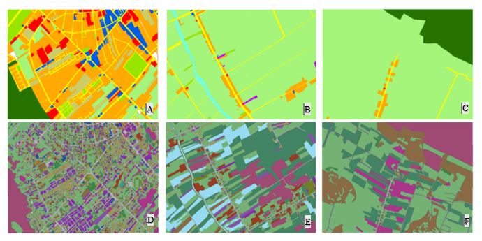
Figure 1: Maps A, B, and C were the original maps extracted from the land-use map acquired from Department of Agriculture Muar year of 2010. Whereas, maps D, E, and F were the updated LULC maps year of 2015.