
3D Subsurface Soil Deformation Data Model

Abstract
Different terrains yield different hydrological processes. Prolonged and continuous precipitation in hillslope areas contributes to the probability of slope failures. Water has the ability to shape the land where soil deformation can occur with the presence of water. Thus, the interaction between subsurface soils with water that has infiltrated the soils should be given adequate attention. This paper will introduce a new data model that integrates an environmental (hydrology and landslide), 3D Geographic Information System (3D GIS) and programming (JAVA) known as 3D Soil water Gravitational Dynamic Flow (3D-SGD Flow) data model. The 3D-SGD Flow data model combines these three main data sets as a foundation in order to provide a better simulation of soil water movement in subsurface soil, which can be used to simulate movement of terrain changes (landslide) in three-dimensional (3D) form. This paper differentiate and combines the past and present approaches and posits the newly modified approach that can be used in the future, when the drawback of each approach is improved and upgraded to fulfil the criteria to build a data model for 3D subsurface soil deformation.
Keywords: Subsurface soilsoil deformationdata model3D GIS3D-SGD Flow
Introduction
Movement of water through soil observed as a dynamism of the convergence of fluid particles (Bear, 1969) where the quick through-flow at a boulder field change dynamically in the deep groundwater and lower valley sides, which generally have a concave profile (Meusburger, 2005). Such instances provoke generation of overland flow as well as groundwater recharge. Prolonged heavy precipitation resulting in the displacement of all preceding increments when the soil reached its maximum capacity where old water that exist on the groundwater will force it out of the bottom end of the hill slope profile.
Rainfall altered the soil surface matrix in mechanical or physic-chemical in nature (Romkens, Prasad, & Whisler, 1990). A number of recent field, laboratory, and modeling investigations have emphasized the role of subsurface flow in stream bank failures (Wilson et al., 2007; Fox, Wilson, Periketi, & Cullum, 2006; Fox et al., 2007; LaSage, Sexton, Mukherjee, Fryar, & Greb, 2008; van Balen, Kasse, & De Moor, 2008; Újvári et al., 2009) and landslides (Onda, Tsujimura, & Tabuchi, 2004; Sidle & Chigira, 2004). Subsurface flow contribution to hazards has been generally neglected in prediction technologies. Therefore, assessment and analysis are required due to insufficient understanding on these processes. Hence, a thorough study of subsurface flow on soil is required in order to build a data model that suitable to represent 3D simulation of soil water movement in subsurface soil. This paper differentiates and combines the past and present studies that lead to approaches that can be used in the future.
Problem Statement
This study consist of three main problem statement:
Soil water deformation induced movement
Movement of water in soil is an important process where it induced the movement of surface terrain. However, soil deformation due to soil water movement is rarely aware of. Rain is a triggering factor that leads to landslide. Although rain is important for soil water movement, the process that happen in soil need to be highlighted.
Rain is the main triggering factor of landslide
The climate in Malaysia are hot and humid all year around. With the larger amount in rainfall intensity, landslides become one of the most critical natural disasters in Malaysia. With high rate of precipitation, the focus on other parameter also need to be considered which is soil deformation and how it cater vast amount of water that can lead to slope instability.
3D for soil deformation for solid to semisolid state for environmental changes
3D visualization primarily used to model the development of a city and architecture. However, it started to be adopted in environment such as for pollution and mining. Since soil deformation does not happen with the same pattern and depends on soil material, the new data model for soil deformation is required to represent the solid (dry soil) to semi solid (wet soil) state which deform with contact with water due to soil water infiltration.
Research Questions
The research question of this studies are:
What is the process happen in soil during and after precipitation that induced soil deformation which lead to landslide and soil erosion?
How 3D soil deformation represent in 3D GIS that include the morphing process of solid dry soil to semisolid wet soil due to infiltration of soil water during precipitation?
Purpose of the Study
The purpose of the study is to:
Determine the important of soil water infiltration in different soil type that induce soil movement
Analyze the most suitable soil deformation representation that can integrate 3D GIS with morphing of soil
Examine the suitability of 3D soil deformation representation
Research Methods
3D object visualization initially used to show the development of a city (Ujang, Anton, & Rahman, 2013), architecture and archeology, but it started to be well acknowledged and used in geology (Wycisk, Hubert, Gossel, & Neumann, 2009) mining (Giuliani, Filipello, & Mandrone, 2016) and in advanced 4 Dimensional (4D) GIS for mining (Iwamura, Muro, Ishimaru, & Fukushima, 2011). Modeling a 3D environment started to urge consideration to investigate on air pollution (Ujang et al., 2013; Liu, Zhu, Wang, & Liu, 2010) virtual environmental geography for outdoor (Huang, Sun, & Li, 2016). Goldman (2004) explained on 3D visualization object that can be divided into rigid, not deform object (Zhao & Luo, 1995) and soft objects, deform object (Shen, Takara, Tachikawa, & Liu, 2006).
Geo-spatial model used to indicate the scope of the earth-related model. A geo-spatial model must be constructed in digital form to enable the system to be maintained and manipulated by the computer system in order to perform tasks and operations that are complex, costly and practically impossible in reality. This research aims to generate a process where dry soil (complete solid) changes its state into wet soil, which is important in soil hydrology.
Since most of natural environmental process involve hydrological processes that include the infiltration of water into soil, there is a requirement for comprehensive and progressive method to describe the deformation of a rigid soil (dry soil) into a semi-rigid soil (water infiltrating into soil). This research aims to create new data models that control the progression of soil in subsurface and movement of soil surface terrain (include temporal data (4D)). Figure
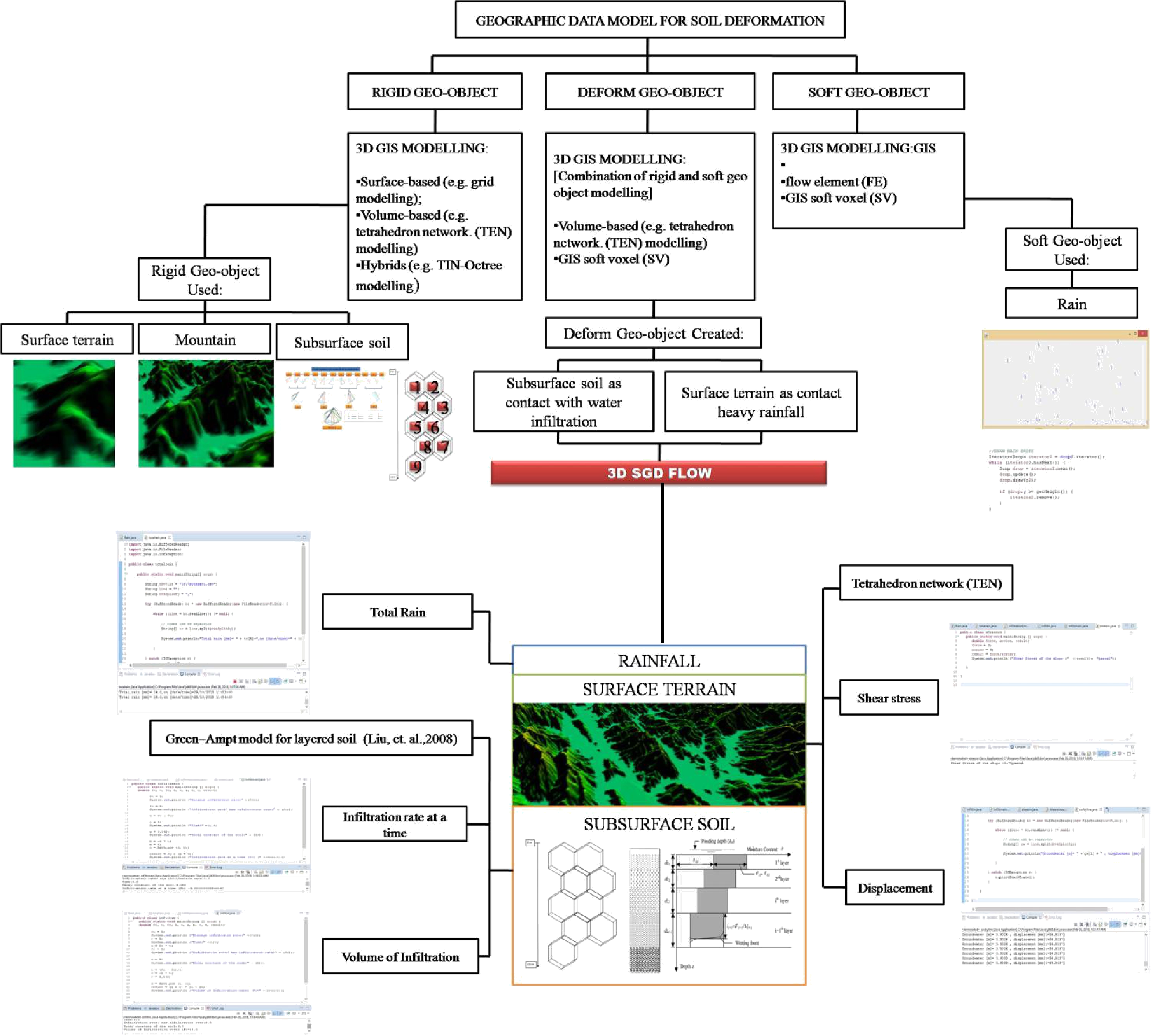
Four main methods were used in this research:
2.5 Dimensional Spatial data representation
The available data of study areas include Digital Terrain Model (DTM), soil erosion maps and roads represent in 2.5 Dimensional Data with ArcGIS10.1 (Figure
Programming
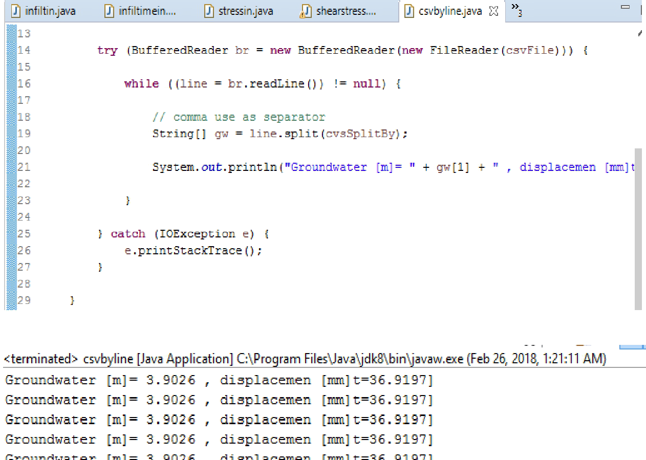
Most of the recorded data, especially a vast amount of recorded data such as hourly rainfall and hourly slope displacement, were in attribute data. To interpret these data into meaningful information that can be used in 3D simulation, the data were imported into a Java program that was used as manipulator of dynamic deformation of soil. In addition, Java was also used for running the equation for infiltration rate over time, volume of infiltration, shears strength and shear stress. One of the code used in this study is shown below (Figure
3 Dimensional (3D) Spatial data representation
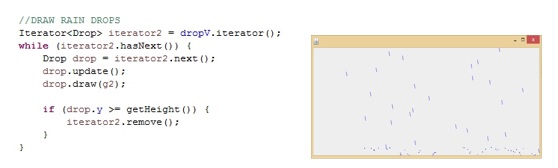
The use of Java is not solely for getting the numerical results. The purpose of using this language is to translate what needed into real representation. The block preparation of a hierarchical soil profile needs a 3D representation. In addition, the rain data based on daily rainfall dynamic data is also need to be translated into better form for a 3D simulation. Some lines of code for rain and 3D rain simulation and its visualization is shown in Figure
Integration of programming and spatial (new data model)
Since this research is still ongoing, the integration of rain with surface terrain, the movement of water during infiltration process, and the deformation of soil due to interaction with soil water is still in progress. The integration of programming and spatial data will create a new data model known as 3D Soil water Gravitational Dynamic Flow (3D-SGD Flow) data model.
Findings
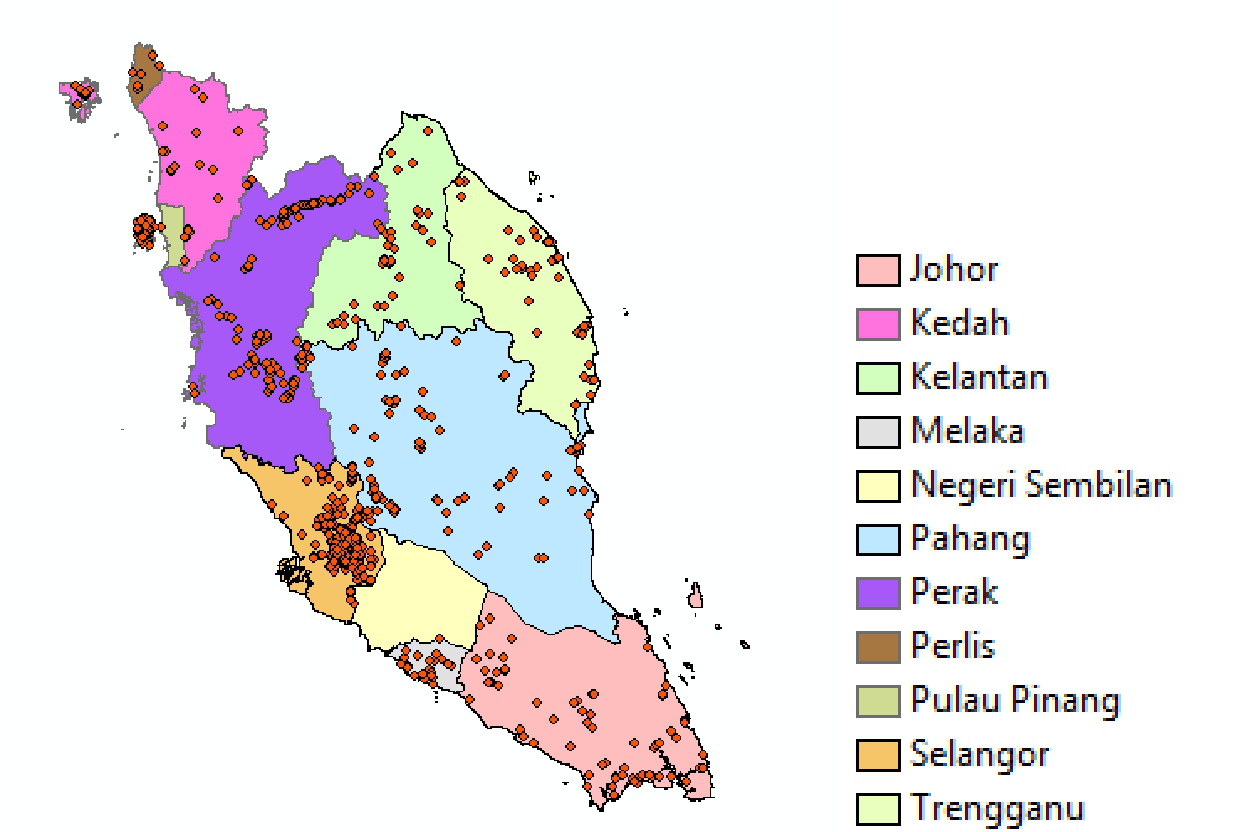
ArcMap 10.1 can provide spatial map on landslide with the availability of latitude and longitude data. This longitude and latitude data shows the location of the landslide that has happen that can gather all historical data of landslide for further used. Other information such as type of landslide, date, number of causalities, causes of landslide and other information can be stored in attribute of every point data where this data later can be manipulated for in depth studies and research. In this research, historical data of landslide until 2017 was mapped in ArcMap 10.1 and the map shows in Figure
Figure
Result for 3D
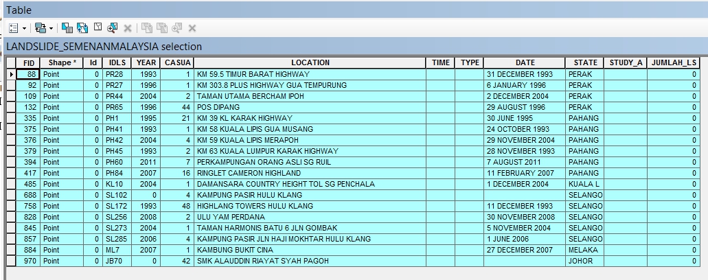
ArcMap 10.1 able to simulate and visualized up to 2.5 Dimension buy using ArcScene. This research applies Processing (JAVA) for enabling the data interaction in JAVA programming with 3D representation of soil water flow and soil deformation. Processing used to create a data model that provide instruction for the visualization of soil water flow and soil deformation of landslide based on the important parameter required. Processing can read various types of data including Comma-separated values (*.CSV) where this data used to map the landslide of the world in 3D (Figure
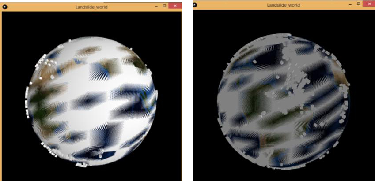
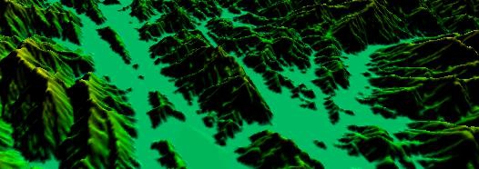
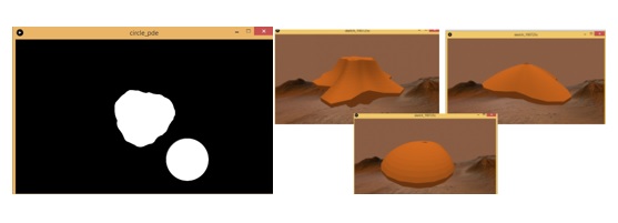
Random walk used to represent the soil water movement in soil. The number of steps in random walk approach infinity. The random walk in 3D started at 300 point data shown in Figure
The time can be adjusted based on soil permeability and the number of point can be increase and decrease based on the precipitation. The deformation of soil in 2D can be done using Processing and this will be used for showing the soil deformation in 3D (Figure
Conclusion
A long continuous rainstorm can lead to hazards such as landslide. Effects of rain sometimes do not take effect immediately but can takes hours or days and might threaten residents that live near hillslopes and drivers that pass through the area. Although most of the research done focused only on precipitation and slope, this research emphasizes the effect of soil water movement in various soil types through the process of infiltration. A 3D-SGD Flow data model produced to combine these three main components (environmental (hydrology and landslide), 3D Geographic Information System (3D GIS) and programming (JAVA)) as a foundation in order to provide a better simulation of soil water movement in subsurface soil, which can be used to simulate movement of terrain changes (landslide) in form of 3 Dimensional (3D). The newly designed 3D-SGD Flow data model is not only important in 3D space but also contributes to the field of environment, geology, hazard management and hydrology.
Acknowledgments
The authors would like to thanks Universiti Sains Malaysia (USM) for providing fund to this research work via RUI Grant No: 816293.
References
- Bear, J. (1969). Hydrodynamic dispersion. In Flow through porous media. New York: Academic Press.
- Fox, G. A., Wilson, G. V., Periketi, R. K., & Cullum, R. F. (2006). Sediment Transport Model for Seepage Erosion of Streambank Sediment. Journal of Hydrologic Engineering, 11(6), 603– 611. http://doi.org/10.1061/(ASCE)1084-0699(2006)11:6(603)
- Fox, G. A., Wilson, G. V., Simon, A., Langendoen, E. J., Akay, O., & Fuchs, J. W. (2007). Measuring streambank erosion due to ground water seepage: Correlation to bank pore water pressure, precipitation and stream stage. Earth Surface Processes and Landforms, 32(10), 1558–1573. https://doi.org/10.1002/esp.1490
- Giuliani, A., Filipello, A., & Mandrone, G. (2016). Extreme gis applications For 3D visualization aimed to geological and mining modeling. Italian Journal of Engineering Geology and Environment, 16(2), 31–39. http://doi.org/10.4408/IJEGE.2016-01.O-03
- Goldman, J. (2004). Introduction to soft and rigid body dynamics in Maya. Available online at: www.ocf.berkeley.edu/,jgoldman/Files/Intro%20to%20Soft%20and%20Rigid% 20Body%20Dynamics.pdf
- Huang, W., Sun, M., & Li, S. (2016). A 3D GIS-based interactive registration mechanism for outdoor augmented reality system. Expert Systems with Applications, 55, 48–58. http://doi.org/10.1016/j.eswa.2016.01.037
- Iwamura, K., Muro, K., Ishimaru, N., & Fukushima, M. (2011). 4D-GIS (4 dimensional GIS) as spatial-temporal data mining platform and its application to managementand monitoring of large-scale infrastructures. In ICSDM 2011 - Proceedings 2011 IEEE International Conference on Spatial Data Mining and Geographical Knowledge Services (pp. 38–43). Retrieved from: http://doi.org/10.1109/ICSDM.2011.5969001
- LaSage, D. M., Sexton, J. L., Mukherjee, A., Fryar, A. E., & Greb, S. F. (2008). Groundwater discharge along a channelized Coastal Plain stream. Journal of Hydrology, 360(1–4), 252– 264. http://doi.org/10.1016/j.jhydrol.2008.06.026
- Liu, X., Zhu, Y., Wang, W., & Liu, F. (2010). 3D GIS modeling of air pollution effects. In 2010 3rd International Congress on Image and Signal Processing (pp. 2714–2717). Retrieved from http://doi.org/10.1109/CISP.2010.5647463
- Meusburger, K. (2005). Combined approach of numeric groundwater modelling with classical and geophysical hydrometry to investigate runoff processes at the hillslope scale. Institut fur Hydrologie.
- Onda, Y., Tsujimura, M., & Tabuchi, H. (2004). The role of subsurface water flow paths on hillslope hydrological processes, landslides and landform development in steep mountains of Japan. Hydrological Processes, 18(4), 637–650. http://doi.org/10.1002/hyp.1362
- Romkens, M. J. M., Prasad, S. N., & Whisler, F. D. (1990). Surface sealing and infiltration. In M. G. Anderson & T. P. Burt (Eds.), Process studies in hillslope hydrology (pp. 127-172). UK, Chichester: John Wilet & Sons.
- Shen, D. Y., Takara, K., Tachikawa, Y., & Liu, Y. L. (2006). 3D simulation of soft geo-objects. International Journal of Geographical Information Science, 20(3), 261–271. http://doi.org/10.1080/13658810500287149
- Sidle, R. C., & Chigira, M. (2004). Landslides and debris flows strike kyushu, japan. Eos, 85(15). http://doi.org/10.1029/2004EO150001
- Ujang, U., Anton, F., & Rahman, A. A. (2013). Unified Data Model of Urban Air Pollution Dispersion and 3D Spatial City Model: Groundwork Assessment towards Sustainable Urban Development for Malaysia. Journal of Environmental Protection, 4(7), 701–712. http://doi.org/10.4236/jep.2013.47081
- Újvári, G., Mentes, G., Bányai, L., Kraft, J., Gyimóthy, A., & Kovács, J. (2009). Evolution of a bank failure along the River Danube at Dunaszekcso{double acute}, Hungary. Geomorphology, 109(3–4), 197–209. http://doi.org/10.1016/j.geomorph.2009.03.002
- van Balen, R. T., Kasse, C., & De Moor, J. (2008). Impact of groundwater flow on meandering; example from the Geul River, The Netherlands. Earth Surface Processes and Landforms, 33(13), 2010–2028. http://doi.org/10.1002/esp.1651
- Wilson, G. V., Periketi, R. K., Fox, G. A., Dabney, S. M., Shields, F. D., & Cullum, R. F. (2007). Soil properties controlling seepage erosion contributions to streambank failure. Earth Surface Processes and Landforms, 32(3), 447–459. http://doi.org/10.1002/esp.1405
- Wycisk, P., Hubert, T., Gossel, W., & Neumann, C. (2009). High-resolution 3D spatial modelling of complex geological structures for an environmental risk assessment of abundant mining and industrial megasites. Computers and Geosciences, 35(1), 165–182. http://doi.org/10.1016/j.cageo.2007.09.001
- Zhao, K. H., & Luo, W. Y. (1995). New Concept physics tutorial: of mechanics. Beijing: Higher Education Press.
Copyright information

This work is licensed under a Creative Commons Attribution-NonCommercial-NoDerivatives 4.0 International License.
About this article
Publication Date
30 March 2020
Article Doi
eBook ISBN
978-1-80296-080-8
Publisher
European Publisher
Volume
81
Print ISBN (optional)
-
Edition Number
1st Edition
Pages
1-839
Subjects
Business, innovation, sustainability, development studies
Cite this article as:
Baidzuri Reli, S. N., Yusoff, I. M., Lateh, H., & Ujang, M. U. (2020). 3D Subsurface Soil Deformation Data Model. In N. Baba Rahim (Ed.), Multidisciplinary Research as Agent of Change for Industrial Revolution 4.0, vol 81. European Proceedings of Social and Behavioural Sciences (pp. 44-53). European Publisher. https://doi.org/10.15405/epsbs.2020.03.03.7